Nate & Summer
Nate & Summer
Things to Do
How to Get to Ceremony and Reception Location
With the ceremony and reception both being located on the Harder's Acreage, we wanted to make sure you can find it!
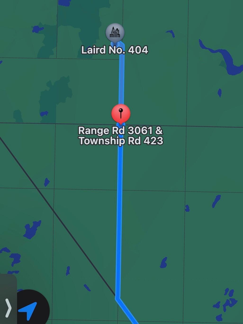
The acreage is located just outside of Waldheim on Range Road 3061. The best way to travel to the acreage is to put into Apple Maps (Google Maps won't work) "Township Road 423 and Range Road 3061" which will bring you to the intersection right before the acreage. From here you will continue on Range Road 3061 North another 2 Km or so and the Acreage will be the first on your left:)
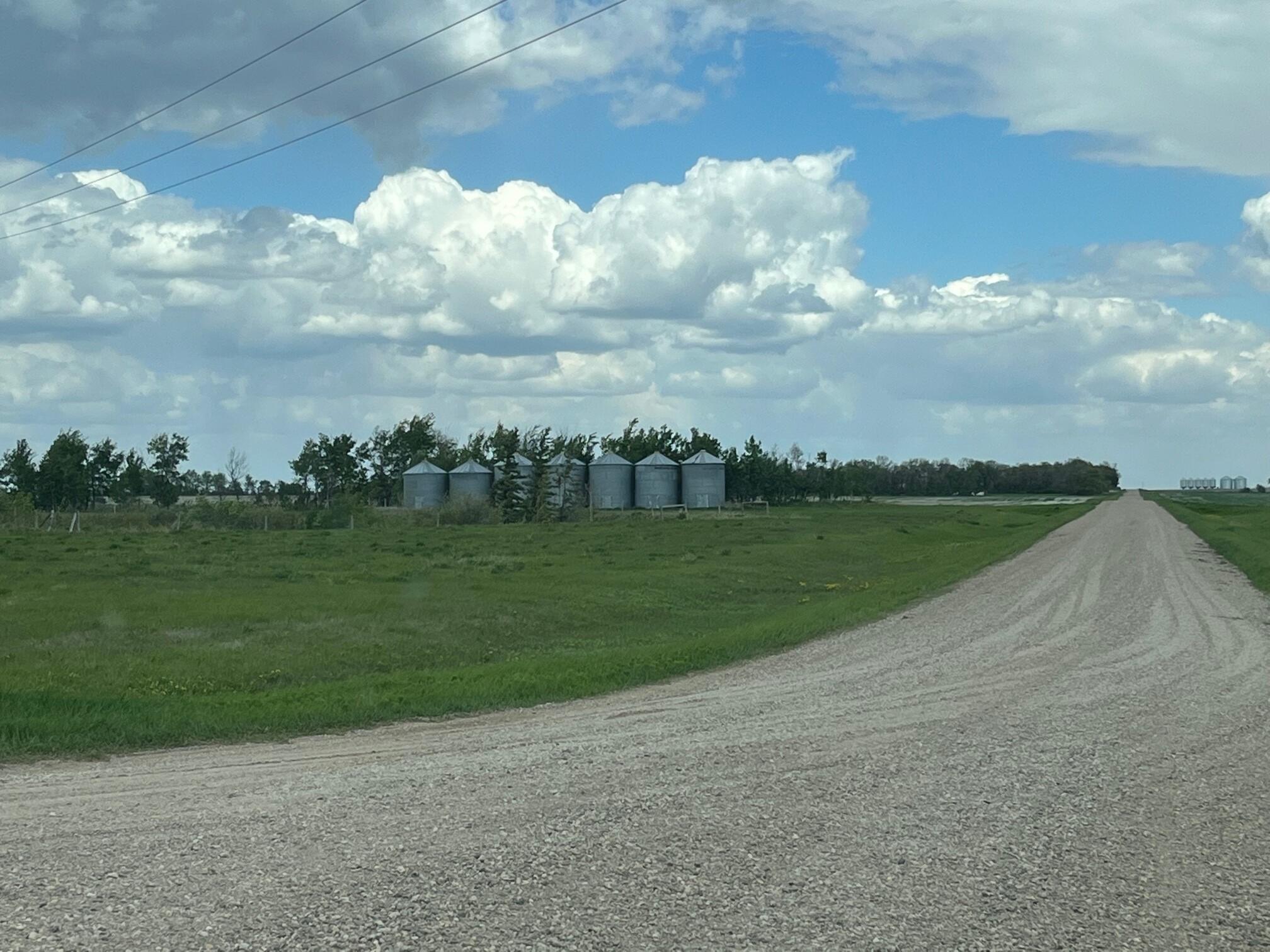
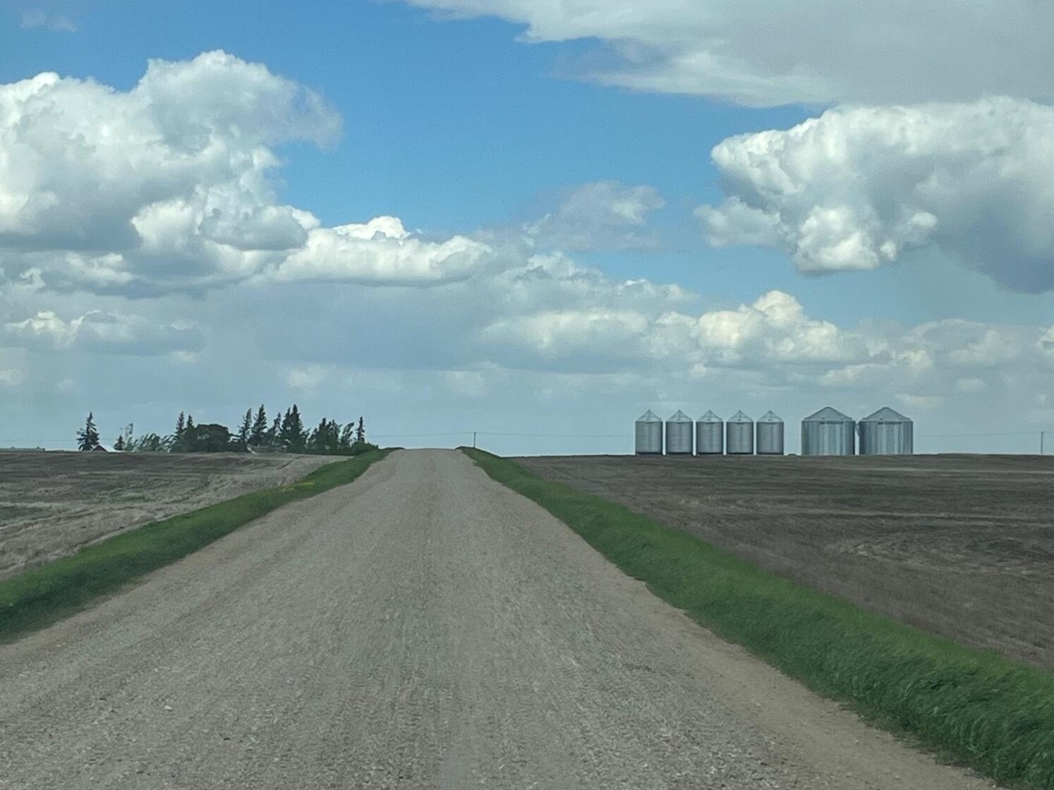
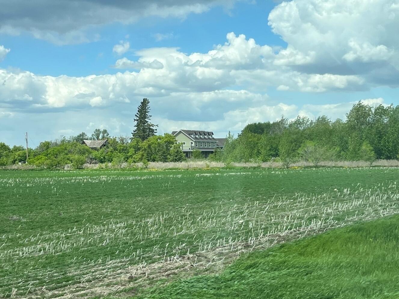
For directions not on a phone, you travel on highway 12 which leads to Waldheim. Instead of turning into Waldheim, you continue on highway 12 towards Blaine Lake. You need to turn right onto Range Road 3061 which is best marked by the 6 grain bins right on the side of the highway (as shown in picture 1 below). As you continue along Range Road 3061, you will see another row of bins on the right side of the gravel (as shown in picture 2), this means you are on the right path! You will continue driving until you meet up with paved highway. You continue straight and Nates acreage is the first farm on the left, around 2 km in. The top of Nate's house can be seen from the gravel, as shown in picture 3.
We will make sure to have balloons or a sign put up to help direct you. If you have any questions on the day of the wedding please call Jeremy Harder @ (306) 260-5407.
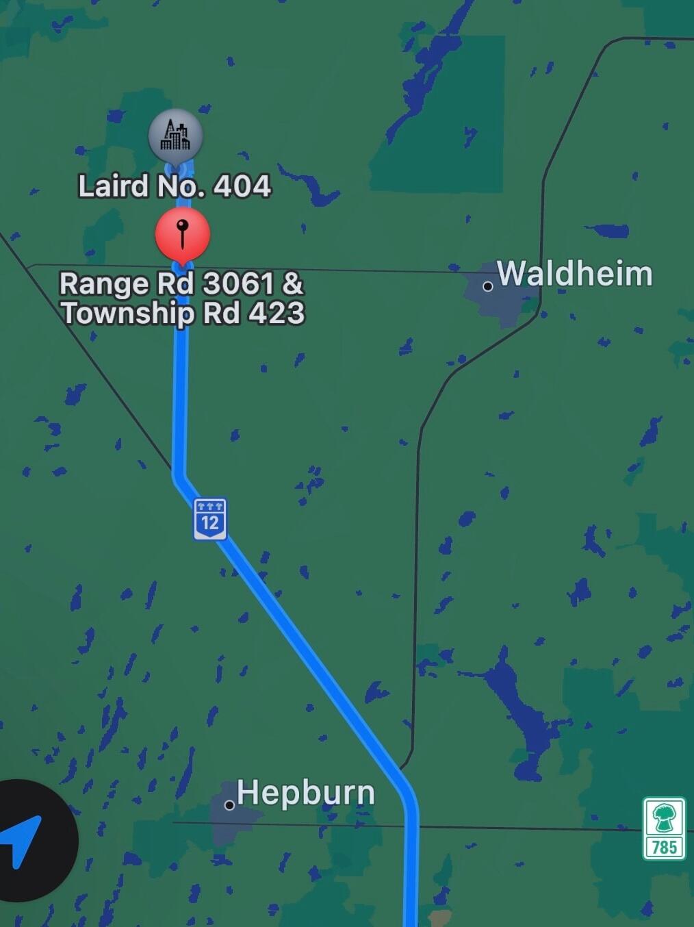
In pictures 4 & 5 we have shown how to continue on to the acreage after reaching the intersection of Range Road 3061 and Township Road 423. If you have any other questions before the wedding don't hesitate to reach out!