
Paul & Jenna
Paul & Jenna
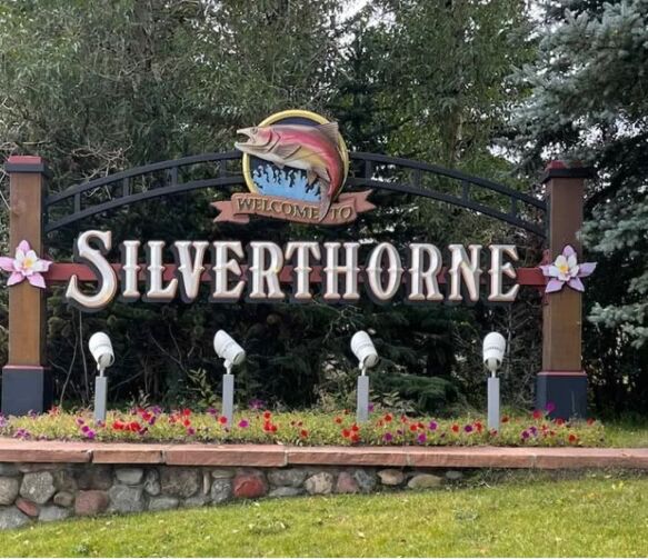
Food In Silverthorne & Dillon

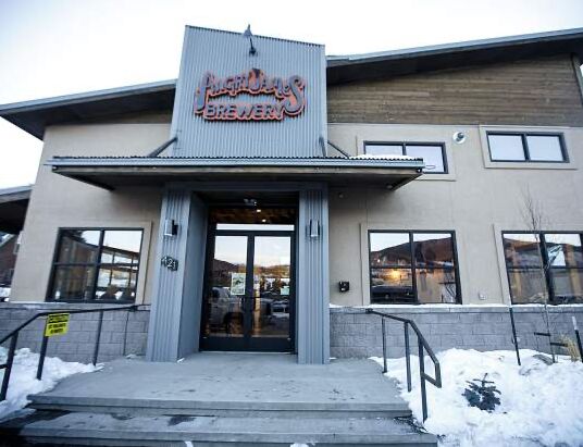
Angry James Brewing

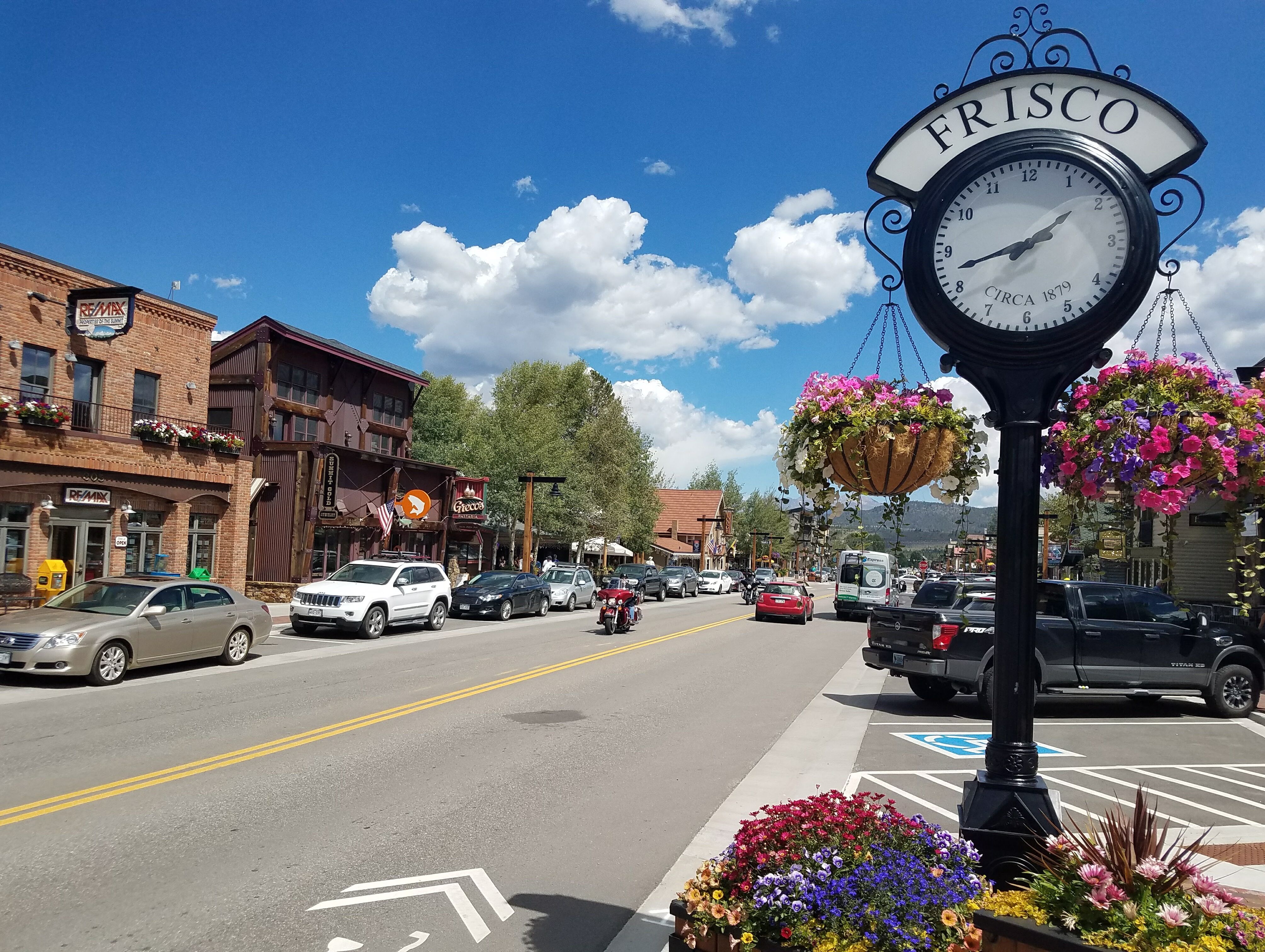
Frisco Main St. Food & Shops

Kayaking And Paddle Boarding, Frisco Marina


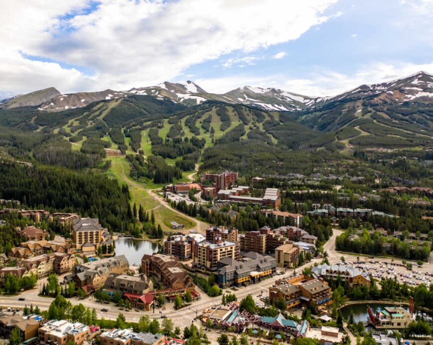
Breckenridge Main St.

Ride a Ski Lift or Gondola!

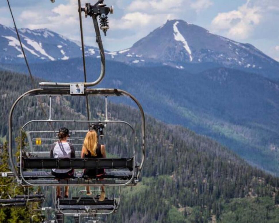
Visit the following ski resorts to ride a ski lift or gondola to the top to walk around and take in the views. After, take the lift back down and eat at a restaurant at the base! Need to go to the office to get a lift ticket.
1) Arapahoe Basin
2) Copper Mountain
3) Keystone
4) Breckenridge
Arapahoe Basin Oktoberfest


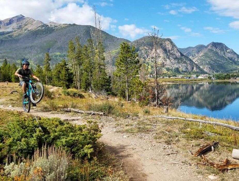
Frisco Penisula and Bike Park

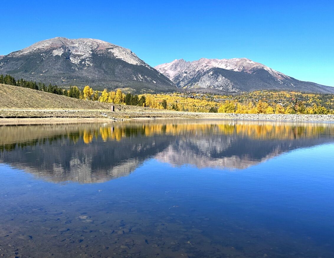
Old Dillon Reservoir Trail

Local Hikes
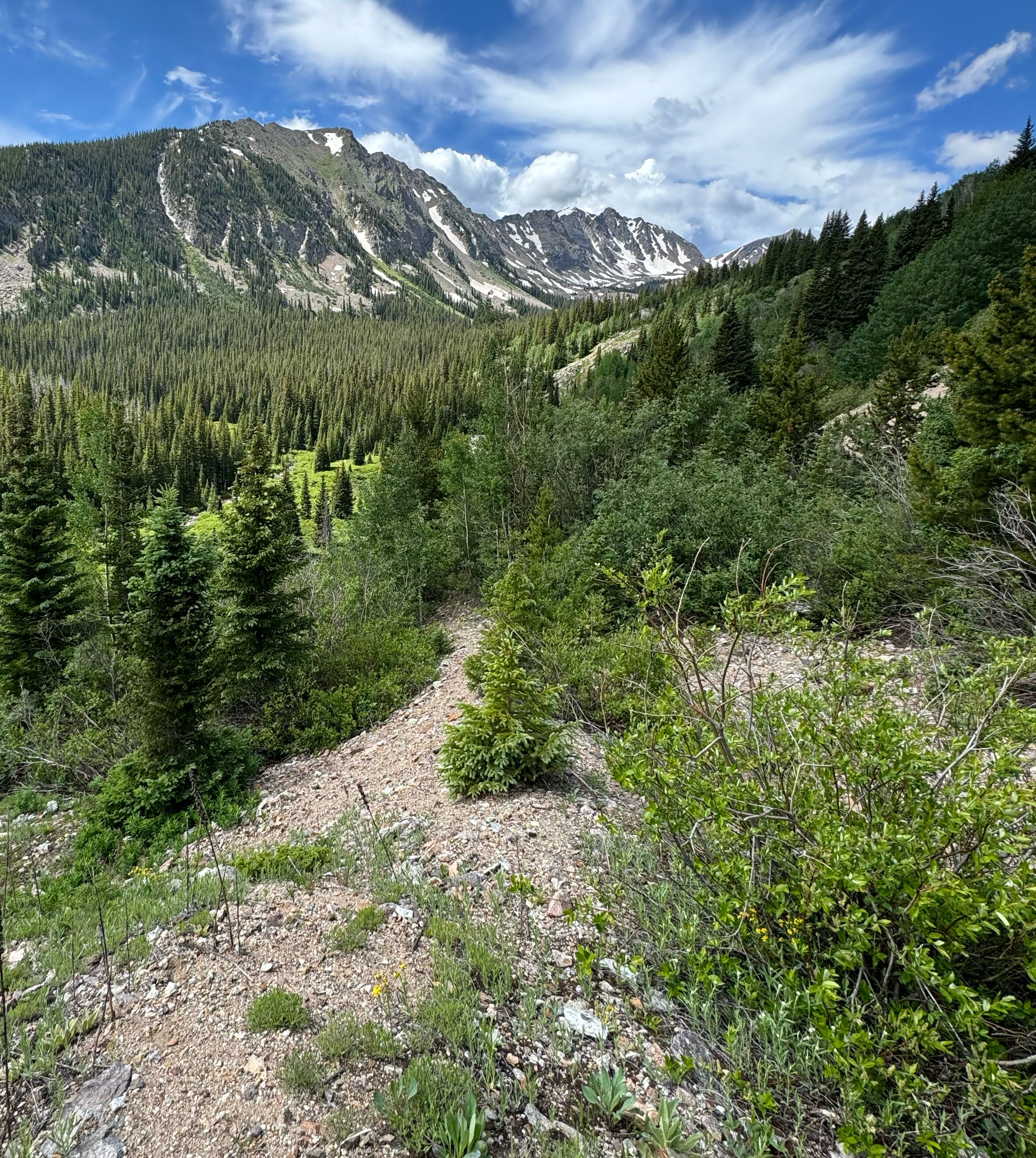
In addition to Old Dillon Reservoir Trail, here is a list of beautiful hikes Paul and Jenna bring Otis to do. To get good maps, photos and information of the hikes download the ‘All Trails’ App. Watch out for deer, moose (Do NOT approach as they are aggressive), and black bears (highly unlikely as they are shy).
Dillon Trails!
1) Meadow Loop and Ridge Trail (easy):
This 3.2 mile long loop with a 475ft gain that goes along the Keystone side of Lake Dillon with overlooks of Peak One, Buffalo, and the Gore Range. Big views, meadows, and intimate trees.
2) Tenderfoot and Oro Trail Loop (moderate):
This 3 mile loop with a 610ft gain that offers beautiful overlooks of Lake Dillon and the local mountains. Big views.
3) Straight Creek Trail (moderate):
This is an in and out, 5.4 miles long trail with 1,200ft gain that meanders along a beautiful creek near the highway and holds an old cabin after the creek crossing. Intimate forest and creeks.
Silverthorne Trails!
1) Lily Pad Lake Trail (easy-moderate):
This is a 3.3 mile hike with 403ft gain, which most is at the start and then it’s relatively flowing. Get to the parking lot early as it fills up quickly! The beginning of this trail has an open, stunning view of Lake Dillon and Keystone Resort and then goes through the forest to a secluded lake. Big view, intimate forest, and mountain lakes.
2) Willow Creek Falls (moderate):
Starting at the Buffalo mountain parking lot, this is a 4.5 mile hike with 1,100ft gain. Same trailhead as the lily pad hike, get to the parking lot early! This one goes through an old burn area with new growth, up and down a steep mountain side, and quite forest to a waterfall! Recommend having a partner for this one as it will lose cell signal along the way. Very intimate forest and water falls.
3) Ptarmigan Trail (moderate to hard):
This is a beautiful hike that gives a stunning view near the beginning of the trail of nearly all of Summit County. Go to the dirt parking lot that sits above I-70. Paul and Jenna usually go until they come across a small creek/wash and turn around, but you can go all the way to the summit if you are REALLY feeling up to it. This is an in and out trail so feel free to turn around whenever. Moderate hike. Going to the top makes it a difficult hike. Big views.
Frisco Trails!
1) Rainbow Lake via Peaks Trail (easy):
This 1.5 mile long trail has only 167ft gain and goes through the forests at the base of Peak One to a mountain lake. Lakes.
2) Mount Royal Trail (hard):
This is a 4 mile hike with 1,400ft gain. The stair master of hikes. Make sure you have proper hiking shoes with great traction and expect to slip and fall on your bottom once on the way down! Rewarding and difficult. Big view.
Nearby Trials outside of Town!
1) Clinton Gulch Dam Reservoir (easy):
This is a 2.4 mile loop trail with 250ft gain. Drive about 30 minutes from Silverthorne towards Leadville. Big views and lakes.
2) Mayflower Gulch (moderate):
This is about a 4.5 mile in and out hike to the cabins with a 1,500ft gain. Drive about 25 minutes from Silverthorne towards Leadville. Beautiful hike that goes up to some mining cabins with a dramatic background of steep mountains. Big views and meadows.
3) Boss Mine via Rock Creek Trail (moderate):
This is a 4.3 mile hike with a 850ft gain. North of Silverthorne. In and out trail to an overview of the gore range mountains and a river below. Download the map ahead of time because cell signal will be gone by the time you get to the trail head. The dirt road is very rough - your car will need to go off roading. Views and river.
4) Boulder Lake (moderate):
This is a 4.5 mile hike with a 750ft gain. North of Silverthorne. Beautiful lake with the gore range mountains behind it. Download the map ahead of time because the cell signal will be gone by the time you get to the trail head. The road may be rough - your car may need to go off roading. Views with lakes.
5) Spruce Creek Trail to Mohawk Lake and Continental Falls (hard):
This is a 6 mile hike with 1,700ft gain. Drive 45 minutes passed Breckenridge. Get to the parking lot early. Popular hike and goes up to a lake with steep mountains behind it.